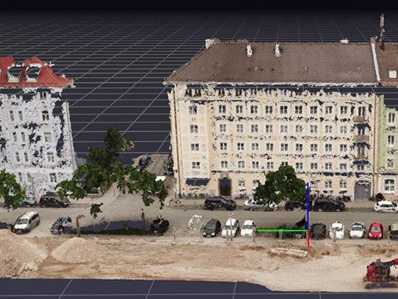
From point cloud to CAD model: winner of a Geospatial World Excellence Award
Turning a point cloud into a CAD model used to be manual work: tracing polylines, object by object, kilometre by kilometre. We automated this step with deep learning – for carriageway edges, markings and structures, at sub-centimetre accuracy. The project won the Geospatial World Excellence Award 2021 in the category Excellence in Transport Infrastructure.
The situation
A CAD model is the format in which as-built data becomes usable for planning. Getting there requires a survey, today usually mobile laser scans – and then the manual transfer of the point cloud into vector geometry.
This last step is the most expensive one. It ties up the working time of qualified surveying staff, requires the corresponding software and infrastructure, and it does not scale: twice the route length costs twice as much. That is exactly why as-built data is collected less often than would make professional sense.
The data
High-resolution mobile mapping LiDAR scans of two German highways, provided by Cloud-Vermessung + Planung GmbH, which surveyed the road network for the Bavarian State Construction Administration, captured with a Trimble MX9 with built-in Riegl scanners.
The second source was decisive: the manually created CAD models of the same sections, with 3D polylines. They are not an accessory but the reference the model learns from – and they contain more than geometry.
Challenges
The model has to learn a convention, not a shape. The central difficulty: objects are represented in CAD models in different ways and are enriched by human prior knowledge. Whether a lane is drawn as the left, middle or right one does not follow from its geometry but from the context – from direction of travel, number of lanes and the drawing convention of the operator.
A model that only learns geometry produces technically correct lines with wrong attributes. That is the difference between a point cloud that looks like a CAD model and a CAD model that can be planned with.
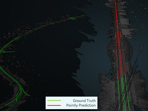
Accuracy below one centimetre. Carriageway edges and markings are the reference geometry for everything built on top of them. A deviation of a few centimetres makes the result unusable for planning.
Approach
Train a pretrained 3D network on the reference models. The basis is a pretrained 3D neural network, fine-tuned on the point clouds and the associated manually created CAD models. That way the network learns not only where an edge lies, but how it is drawn in the model.
A modular pipeline in Microsoft Azure. Processing is built modularly and can be scaled by adding workers. That is the precondition for a single section of route growing into a road network without touching the architecture.
Build on the classification. The method builds on the automated classification of the point clouds: first the semantic assignment, then the vectorisation. Solving both steps in one model would be harder to verify and harder to correct.
Outcome
Detection of road outlines and CAD generation reach sub-centimetre accuracy. Manual effort and costs drop considerably for the Bavarian State Construction Administration; larger sections of route can be captured in a fraction of the time, and the errors that creep in during hours of manual tracing disappear.
The Geospatial World Excellence Award 2021 in the category Excellence in Transport Infrastructure recognised the project – an assessment by a third party, not a claim of our own.
Transferability
The task – generating vector geometry from a point cloud that follows a professional drawing convention – is the same for railways, utility networks, sewer structures and the as-built survey of buildings. The transferable part is the insight that the manually created as-built models are not legacy baggage but the most valuable training dataset in the house: they hold the convention knowledge that is documented nowhere else. Today we deliver projects of this kind together with our sister company Pointly as our technology partner.
Today
The need has intensified, because as-built data is no longer required as a CAD model alone. Where BIM requirements apply to transport infrastructure, the target is a building information model with attributes and relationships, not a collection of polylines – so today we would orient the output towards open BIM formats and not towards CAD alone. Technically, transformer-based point cloud models have taken the place of older 3D architectures, and for the vectorisation itself there are now methods that predict polylines directly instead of retracing them from a segmentation. We would set the pipeline up cloud-natively on Cloud-Optimized Point Cloud, so that a section can be processed without loading the full scan. What remains unchanged: quality hangs on the reference models. Without cleanly drawn as-built models, there is no convention to learn.
Last updated: 6 August 2026