

Geo AI
From object detection on satellite imagery through asset registers to the analysis of LiDAR point clouds: we develop AI solutions for geodata – and quantify areas instead of describing them.
Remote sensing, 3D point clouds and spatial analysis, end to end – from proof of concept to production operation.
We have been working on geodata continuously since 2017 – for road administrations and for industrial and agricultural companies: wind power and photovoltaic registers from satellite and orthophoto data, highway scans at centimetre accuracy, forest inventories from LiDAR, infestation detection in forestry, road condition prediction.
Two of these client projects – the highway scans and the forest inventory – gave rise to a platform for 3D point clouds, and from it a company of its own: Pointly classifies and vectorises point clouds and carries that technology forward today as our sister company. Projects involving 3D point clouds are therefore delivered together with Pointly – the geodata and modelling work with us, the platform and point cloud tools with Pointly. For you it remains one point of contact and one project plan.
The difference rarely lies in the model; it usually lies in the steps before it: radiometric correction before classifying, georeferencing so that a measured area can be assigned to a place in the terrain, and training and test data split by area rather than by image tile. Anyone who skips these steps produces the same percentages – just wrong ones.
And we deliver end to end: from the first proof of concept to the production analysis you will run for years. As an extension of your own team where that suits you better.
What is Geo AI?
Geo AI combines artificial intelligence with geographic information systems (GIS) and remote sensing data. It makes spatial data analysable at a scale and accuracy that classical GIS methods cannot reach: satellite, aerial and drone imagery, LiDAR point clouds and time series become objects, classes and metrics with coordinates.
Three core components carry this: computer vision for object detection and segmentation on aerial and satellite imagery, 3D point cloud analysis for LiDAR and photogrammetry data, and spatial AI for prediction, optimisation and change detection.
Reference projects
A wind turbine register from satellite imagery. In a proof of concept with Esri, a U-Net processed 280,000 satellite image tiles of one square kilometre each and mapped 3,300 wind turbines with location and type – the foundation for siting new turbines. Trained on 500 images. Read the use case →
Highway scans: from point cloud to CAD model. We classified mobile LiDAR scans of two German highways (capture accuracy ±1 cm) automatically and derived CAD models from them – road markings, kerbs, structures. New scans are classified in hours instead of weeks of manual work. The project won the Geospatial World Excellence Award 2021 in the category Excellence in Transport Infrastructure. The point cloud technology from this project is carried forward today by Pointly; comparable projects are delivered jointly. Classify point clouds → · Generate CAD models →
An automated forest inventory from LiDAR. Point clouds from the air and from the ground become individual tree instances with position, height and crown extent – usable directly as map layers. For RAG, which monitors the consequences of mining over decades. The method is being continued together with Pointly. Read the use case →
Mapping bark beetle infestation automatically. A neural network detects dead trees on aerial imagery at 0.2 m resolution and reaches 98.6% recall against the training labels. Infestation hotspots appear as heatmaps. Read the use case →
Detecting and mapping photovoltaic modules. 47,818 digital orthophotos from the open geodata of the German state of North Rhine-Westphalia (NRW), 0.1 m resolution, four spectral bands, processed with Mask R-CNN – closing the information gap on where renewable generation is actually already installed. Read the use case →
Further projects: predicting the A70's road condition across three survey years · segmenting concrete cracks to the pixel (97% true positive rate) · detecting trucks in orthophotos (over 99%) · instance segmentation on point clouds of up to 10 million points · drone-based crop damage assessment · yield prediction across 20,000 sites · estimating crowd density from imagery · space-time analysis of CO2 emissions · spatial location optimisation
Application areas
- Remote sensing and image analysis: object detection, segmentation and classification on satellite, aerial and drone imagery – multispectral, hyperspectral and thermal.
- 3D point clouds (together with Pointly): classification, semantic segmentation and vectorisation of LiDAR and photogrammetry data – the point cloud becomes objects, lines and areas that can be worked with. These projects are delivered together with our sister company Pointly, which holds the point cloud technology.
- Asset and energy registers: area-wide mapping of wind turbines, photovoltaics and infrastructure from remote sensing data – with location, type and condition.
- Transport routes and structures: as-built capture from mobile scans, derivation of CAD models, condition assessment on imagery, road condition prediction from condition and traffic data.
- Forestry and vegetation: inventories of individual trees, vitality monitoring, infestation detection, tree species mapping and biomass estimation.
- Spatial analysis, optimisation and operations: location and network optimisation, crowd densities, space-time analyses, change detection over Sentinel archives and cloud-native processing with Cloud-Optimized GeoTIFF, STAC and PDAL – so that an analysis scales from a single site to a region.
Remote sensing, GIS and spatial data analysis
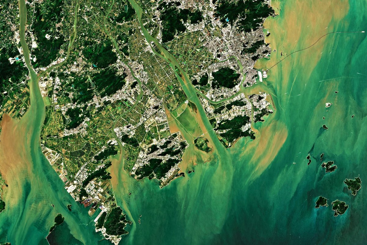
Geodata analysis combines GIS, remote sensing and machine learning to quantify areas. Satellite, aerial and drone imagery become object counts and area shares, point clouds become heights, volumes and vector models, time series become trends and changes.
- Object detection and pixel-accurate segmentation on high-resolution imagery
- Classification and vectorisation of LiDAR and photogrammetry point clouds – together with Pointly
- Change detection and time series analysis over satellite archives
- Scaling from a single site to a federal state: drone and mobile mapping for accuracy, satellite data for coverage
From proof of concept to platform
Most AI initiatives fail not at the model but at the transition into operation. We cover the entire chain ourselves – you do not need a second partner for industrialisation.
- Data Consulting – clarify the question and the data situation
- Data Lab – prototype on your data
- Data Operations – production use with MLOps
- Data Infrastructure – scalable cloud architecture, hosting in Germany and the EU
Working together: data security and regulatory context
We are certified to ISO/IEC 27001:2022 (TÜV Rheinland, reg. no. 01 153 2300149). Processing and hosting take place in Germany and the EU. We use client data solely for the agreed project and never to train our own models. We provide the certificate and our documentation of technical and organisational measures to your procurement team on request.
With geodata, two further points apply. Aerial and street-level imagery can contain personal data, which we anonymise before it enters training or analysis – and where people are involved, we work with density estimation instead of identification. And the licence terms of commercial satellite and official aerial imagery often also govern who may use and pass on the results derived from them; we settle that question with you before the modelling starts. For the requirements of the EU AI Act we offer our AI Compliance Check.
Let's talk about your project
Whether it is aerial image analysis, point cloud classification or a register covering an entire region: we start with an appraisal of your data situation, not with a proposal.